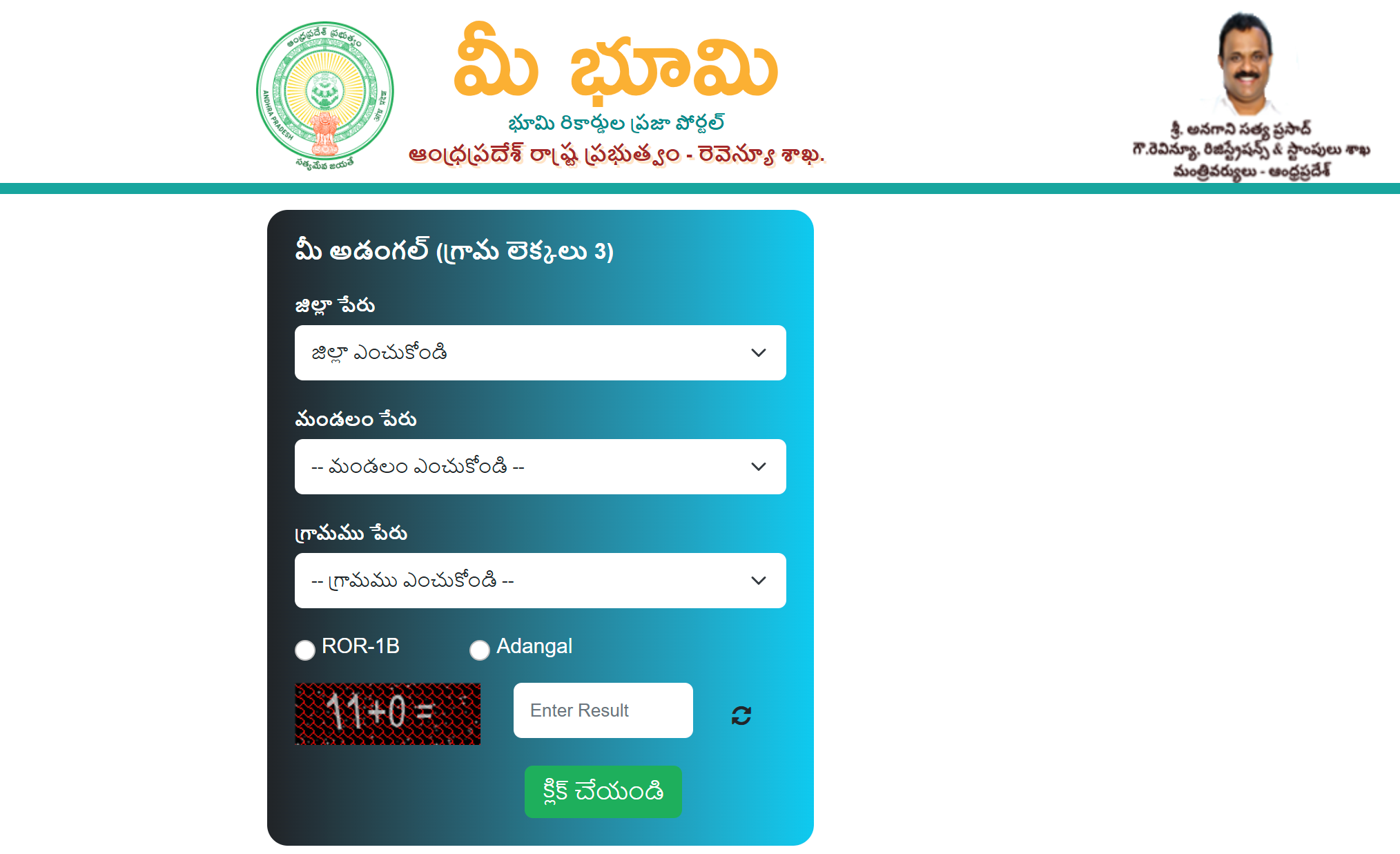
The Meebhoomi AP portal, launched by the Andhra Pradesh Revenue Department in June 2015, is a digital platform that revolutionizes access to land records.
Among its offerings is the Field Measurement Book (FMB), a critical document that provides detailed maps and measurements of land parcels, including boundaries, survey numbers, and sub-divisions. The FMB is essential for verifying land dimensions, resolving disputes, and facilitating property transactions.
What is the Meebhoomi AP Field Measurement Book (FMB)?
The FMB is a cadastral record that contains map-based data of land parcels, maintained by the Revenue Department at the district or Tehsildar level. It includes:
- Survey Sketches: Maps drawn to a scale of 1:1,000 or 1:2,000, showing land boundaries and sub-divisions.
- Measurements: Precise dimensions of the land, including length, width, and area (in acres/hectares).
- Survey Numbers: Unique identifiers for each land parcel, with sub-division numbers for individual owners.
- Boundary Details: G-lines (imaginary boundary lines), F-lines (actual field boundaries), and extension lines (neighboring fields).
- Topographical Features: Nearby landmarks, roads, or water bodies.
The FMB is crucial for:
- Verifying land boundaries before buying or selling property.
- Resolving disputes over land dimensions or encroachments.
- Supporting legal processes, such as court cases or loan applications.
- Assisting in land planning and development projects.
Step-by-Step Guide to Accessing Meebhoomi AP FMB
Follow these steps to access the FMB on the Meebhoomi portal:
Visit the Official Meebhoomi Portal
- Open a web browser and navigate to meebhoomi.ap.gov.in.
- Locate the FMB Option
- On the homepage, find the section labeled “మీ భூమి వివరాల కోసం క్లిక్ చేయండి” (Click for Land Details).
- Click on “మీ L.P Map/FMB/గ్రామ పటం” (Your LP Map/FMB/Village Map).

Select Location Details
- Choose your District, Mandal, and Village from the dropdown menus.
- Example: For a plot in Guntur, select “Guntur” (District), “Tenali” (Mandal), and “Kollur” (Village).
Choose Search Criteria
- Select one of the following options to access the FMB:
- One Khata Number: Unique identifier for the landowner’s account.
- Village Map: Displays all land parcels in the village, including FMB data.
Khata Numbers (e.g., “1234567890123”) are found in 1B records, E-Passbooks, or old land documents. Survey Numbers (e.g., “45/2A”) are plot-specific and listed in sale deeds.

Enter Required Details
- Input the Khata Number or select “ Village Map” as per your choice.
- For Khata Number, ensure the number is accurate, as errors will result in no records.
- For Village Map, no additional input is needed beyond location details, but the output may include multiple parcels requiring manual filtering.
Submit and View FMB
- Click “క్లిక్ చేయండి” (Click) or “Submit.”
- The FMB sketch or Village Map will appear, showing:
- Detailed map with survey numbers and sub-divisions.
- Boundary lines (G-lines, F-lines, and extension lines).
- Measurements of the land parcel.
- Neighboring field survey numbers.
- Click “Print” to download the FMB sketch as a PDF or print a hard copy.
Alternative Access via BhuNaksha AP Portal
- For geo-referenced FMB maps, visit the BhuNaksha AP portal at bhunaksha.ap.gov.in.
- Steps:
- Select District, Mandal, Village, Type, and Survey Number.
- Check the “Field Measurement Book” box.
- Click “Map Report” and select “Single Plot” or “All Plots of Same Owner.”
- Download the FMB report as a PDF.
- Advantage: BhuNaksha integrates satellite imagery (via ISRO’s Bhuvan platform) for precise, zoomable maps.
Practical Applications of the FMB
- Property Transactions: Verifies exact boundaries and measurements before buying or selling land.
- Dispute Resolution: Provides evidence in court for boundary disputes or encroachments.
- Bank Loans: Banks accept FMB sketches as part of collateral documentation.
- Land Planning: Assists in urban/rural development by providing accurate parcel data.
- Government Schemes: Supports applications for subsidies or land-related benefits.
Additional Meebhoomi Services
Beyond FMB, the Meebhoomi portal offers:
- 1B Records: Ownership and mutation details (see previous artifact).
- E-Passbook: Consolidated land holding summary (see previous artifact).
- Adangal: Crop, soil, and irrigation data.
- Village Maps: Broader maps showing all land parcels in a village.
- Aadhaar Linking: Enhances security for record access.
- Dispute Status: Tracks land-related court cases or grievances.